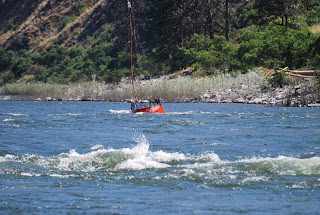
This is a larger version of the jet boat we rode on the Snake River.
We saw a lot more basalt rock formations,
and noticed that the Snake has rapids, this one only stage two.
There is private property along the river at places, every thing has to be brought in by boat, helicopter, or airplane. Do you believe this is an airstrip?
There are other ways to see the canyon, some float trips down the Salmon and joining the Snake take a week.
This is the Salmon joining Snake.
We also saw some wildlife, like this female mountain Sheep.
The rest of the family were a little shy,
But the little guy did have a little lunch while we watched.
The rapids seem to be getting stronger.
Lightning started a forest fire the day before we took our tour, and we happened to have an opportunity to see how the fire fighters use their helicopters.
This is the boat we actually rode in. Thats Gail holding down the fort.
We stopped at a facility of the boat company for lunch on the way back, and we saw some of the wild turkeys they are trying to re-introduce to the Snake River valley.
While we were there, a mule deer ambled by.
We were treated to a good view of some prehistoric petroglyphs left by the ancestors of the Nez Perce Indians.
After the boat ride we stopped by a spot in Lewiston where the Clearwater meets the Snake River.
When we returned to the hotel, Gail remembered that night was an opportunity to see the Northern Lights. A local resident told us that the hill to the north of us could be ascended via a very winding road to an observation place at the top. After dark, we turned off I-95 and followed hwy 128 up a very, very winding road up about 2700 feet to the top, where the local TV and radio station antennas blinked their red lights into the void. By void we mean we followed the limited bubble of light produced by our headlights, which was the only illumination. The void that we knew was on one side went down precipitously at the very edge of the road. A steep embankment dominated the other side of the road. It was eerie and contributed greatly to Gail's consternation. When we crested the summit, we found that we had intersected I-95!! We crossed and entered a pull-off, shut down the car and lights and waited for the Aurora, and waited, and waited. After the second time John dozed off, Gail decided we should head back. Obviously we had not needed to ascend by the goat path on the south side of the hill, and did not need to descend that way. I-95 was no breeze, though. It is a 7 percent grade, trucks were warned to not exceed 35 mph and there were truck escape routes on both sides of our lanes about every one half mile. The escape exits appeared to be on soft ground, which the trucks would bog down in to slow down, as there was no "up" up there. An interesting experience, maybe will be able to see the solar eclipse.
Next we plan to camp out a few days in a Corps of Engineers campgound on the Snake River East of Pasco.


2 comments:
The basalt formations in the second photo show a columnar character similar to an area in Iceland where the Gold Falls are located.
The firefighter aircraft are pretty amazing, but seem so small compared to the huge holocaust of forest fires. They do awesome work,nevertheless!
As an aside, my physical therapist at Andrews is from the area you're exploring. He says he and family members hunt around there. Last week he provided a description of much of the river flute, the locations of dams and fishing lakes and places he has the most success.
The 3D view available on Google Earth has added to the fun of following your journey. Even has a "street view" that lets me get a good sense of topography.
We appreciate your comments, Bob, It's nice to know that others are enjoying what we are seeing too. I got a lot of pictures of the helicopters, of course,
and believe it or not, there was an even smaller one dipping his bucket here. It was interesting to see how that bucket is designed to pick up the water.
I'll have to try the 3d view.
John
Post a Comment