Friday, July 21, 2017

Camping on the Snake

On the way to the campground, we stopped by for a look at Palouse Falls.


It's amazing to drive through mile after mile of arid plains and come across a 190 foot waterfall emanating from a fissure in the basalt


But we are used to seeing castles of rock looking down on the action below.


Here is the camp we set up on the banks of the Snake River.


We were fascinated that we drove through hundreds of acres of fruit trees as we descended to the valley of the Snake in Eastern Washington.


In Sacagawea State Park we observed the confluence of the Snake with the long awaited Columbia River.


That's the Snake coming through that bridge in the distance and joining the Columbia in the foreground.


On October 19, 1805 Clark climbed this 200 feet prominence to get his first view of the snow capped peaks to the west.

We couldn't resist the short drive to see Hat Rock.


Here is our first glimpse of mount Hood, we think


We get some good views of the Columbia River Valley along Washington road 14 on the north side.


But John is not relieved of his wildflower duties.


We are staying a few days at The Dalles, doing laundry, blogging, and sight seeing. Tomorrow we plan to run down river and take a paddle wheel cruise on the Columbia.

Thursday, July 20, 2017

Hells Canyon

Hells Canyon is the deepest canyon in North America, half again as deep at its deepest part than Grand Canyon. We took a two hour jet boat tour tour on the Snake River in Hells Canyon.


This is a larger version of the jet boat we rode on the Snake River.


We saw a lot more basalt rock formations,


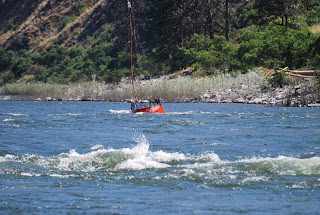
and noticed that the Snake has rapids, this one only stage two.


There is private property along the river at places, every thing has to be brought in by boat, helicopter, or airplane. Do you believe this is an airstrip?


There are other ways to see the canyon, some float trips down the Salmon and joining the Snake take a week.


This is the Salmon joining Snake.


We also saw some wildlife, like this female mountain Sheep.


The rest of the family were a little shy,


But the little guy did have a little lunch while we watched.


The rapids seem to be getting stronger.


Lightning started a forest fire the day before we took our tour, and we happened to have an opportunity to see how the fire fighters use their helicopters.


This is the boat we actually rode in. Thats Gail holding down the fort.


We stopped at a facility of the boat company for lunch on the way back, and we saw some of the wild turkeys they are trying to re-introduce to the Snake River valley.


While we were there, a mule deer ambled by.


We were treated to a good view of some prehistoric petroglyphs left by the ancestors of the Nez Perce Indians.


After the boat ride we stopped by a spot in Lewiston where the Clearwater meets the Snake River.


When we returned to the hotel, Gail remembered that night was an opportunity to see the Northern Lights. A local resident told us that the hill to the north of us could be ascended via a very winding road to an observation place at the top. After dark, we turned off I-95 and followed hwy 128 up a very, very winding road up about 2700 feet to the top, where the local TV and radio station antennas blinked their red lights into the void. By void we mean we followed the limited bubble of light produced by our headlights, which was the only illumination. The void that we knew was on one side went down precipitously at the very edge of the road. A steep embankment dominated the other side of the road. It was eerie and contributed greatly to Gail's consternation.  When we crested the summit, we found that we had intersected I-95!! We crossed and entered a pull-off, shut down the car and lights and waited for the Aurora, and waited, and waited. After the second time John dozed off, Gail decided we should head back. Obviously we had not needed to ascend by the goat path on the south side of the hill, and did not need to descend that way. I-95 was no breeze, though. It is a 7 percent grade, trucks were warned to not exceed 35 mph and there were truck escape routes on both sides of our lanes about every one half mile. The escape exits appeared to be on soft ground, which the trucks would bog down in to slow down, as there was no "up" up there. An interesting experience, maybe will be able to see the solar eclipse.

Next we plan to camp out a few days in a Corps of Engineers campgound on the Snake River East of Pasco.

Sunday, July 16, 2017

Lost Trail Pass Lolo pass and behond

After conquering Lehmi Pass we headed north and climbed Lost Trail Pass. The Corps had a terrible time because their Shoshone guide lost the trail and led them over a ridge 1000 feet higher than we had to to reach the summit. We then proceeded on northward in the Bitterroot valley throgh which the Salmon River flows.


It's a pretty little valley named after the Bitterroot Mountains with a fine looking river.


When the Corps noted that the Salmon turns west, and must connect with the Columbia they decided they should follow it. The Indians told them that some had tried but they call the Salmon the River of No return. Capt Clark inspected it and agreed that they could not navigate it with canoes.


We drove down Forest 30 along the Salmon and agree with the Indians.

On the way to Lolo we stopped and visited a chapel that was built by Father De Smet, who was an early Missionary to the Indians of the Bitterroot Valley.

Continuing north, now along the Bitterroot River, we come to the confluence of that river and Lolo Creek. This is the place called Travelers Rest where the Corps camped on September 9th and 10th.


From here they turned west and followed the Lochsa River and  Clearwater River to cross Lolo Pass.
It is easy to see why they call it the Clearwater River.


As a matter of fact, Gail and Doc had to inspect it at close range.

Actually they had to soak their feet for a while


We had no problem sumiting Lolo Pass on Highway US 12. The Corps had a terrible time. They expected one range, they actually had range after range. Srrgeant Gass said it was the most terrible mountains he had ever seen. Captain Clark said he had never been colder or wetter. When they passed Lolo Hot Springs, Clark said it was hot and not bad tasting. We found it the same when we spent the night at the Lolo Hot Springs Resort.

The Corps were wet, cold and hungry. Killed Colt creek is a camp site at which they did that very thing, to stave off starvation. They finally left the mountains behind near present day Weippe Prarie. The met the Nez Perce indians who fed them and helped them make dugout canoes to continue their journey by water. This place is called Canoe Camp and looks like this

Here they made canoes similar to this, small and large. The large ones were 55 feet long! That is how long the Keel Boat was.


We spent several days at Lewiston Idaho, which is 40 miles down stream from Orofino, which is where Canoe camp is located.

Lewiston is at the confluence of the Snake River and the Clearwater River. Next we investigate the Snake River in Hells Canyon.

Voyage of Disovery Map

Voyage of Disovery Map